Kilwa
Kilwa
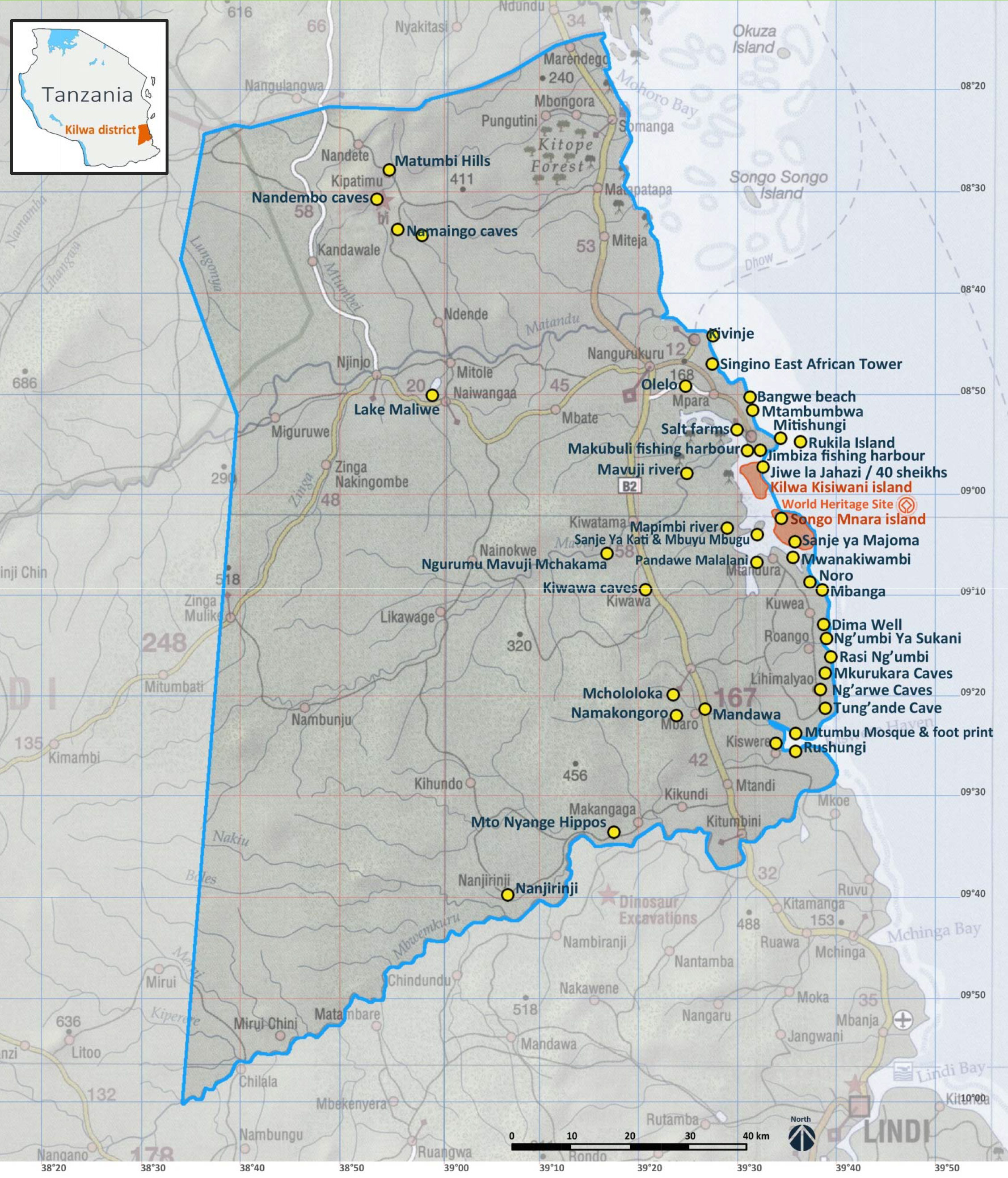
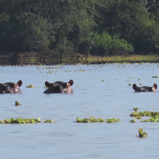
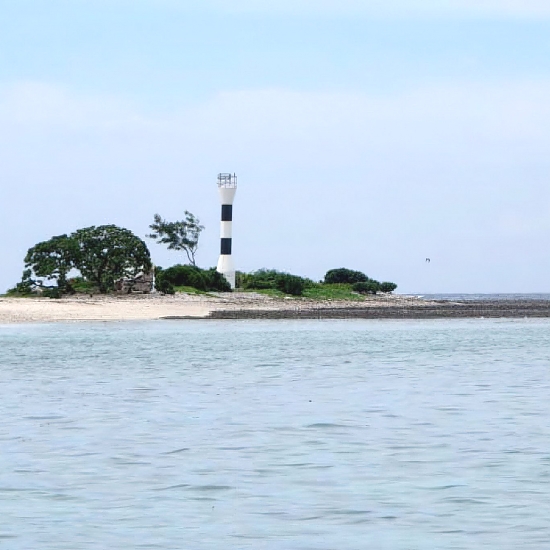
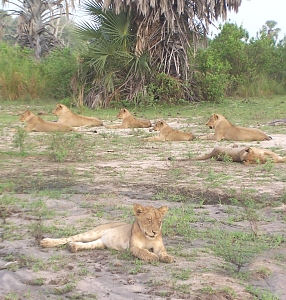
Kilwa is one of six administrative districts of Lindi Region in Tanzania. It has a total area of 13,347.50 square kilometers, Kilwa district has 5 Islands, with the largest one being Kilwa Kisiwani. The other islands in the Kilwa archipelago are Island and Songo Mnara Island. In addition, the Songosongo Islands archipelago is composed of 21 coral reefs including the 4 coral islands. The four Islands in the archipelago are Fanjove, Nyuni Island, Songo Songo and Okuza Island. Kilwa District is home to Pindiro Forest Reserve where albino hippopotamuses have been observed.
The Matandu River is the largest river running west to east of Kilwa district. The other rivers found in the district are the Mbwemkuru River, Matandu River and the Mavuji River. There is also a cave system in Kipatimu ward, the Nan'goma Cave. The cave system is located in the Matumbi Highlands which are shared between Kilwa District and Rufiji District in Pwani Region.
Historicaly he area that is now Kilwa district has been inhabited by humans for thousands of years. The area is the ancestral home to three Bantu people groups, namely the Mwera people and the Matumbi people together with the Machinga people. The Matumbi being historically the majority native group inhabiting the most land in the district. They are the natives of the entire central and northern Kilwa district and Kilwa's islands. The Machinga people are native to the south eastern section of the district to the border with Lindi District. The Mwera inhabit the south west part of the district.
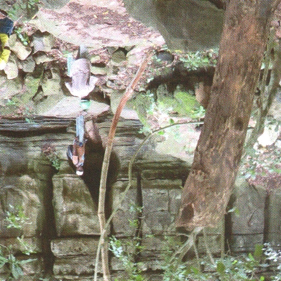
The three tribes became swahilized in the 9th century with the arrival of Islam in the region transforming the region to its being one of the wealthiest Swahili city states on the continent by the 14th century. Kilwa district is known globally for its Middle Ages Swahili historical sites from Middle Ages on the islands Kilwa Kisiwani and Songo Mnara which are part of the seven Tanzanian World Heritage Site.
The Swahili city-state of Kilwa was once the greatest Swahili port city that met an unfortunate end on July 1505 when the Portuguese burned and looted the city. In the 1866 the area of what is now Kilwa district was occupied by Germans who established their headquarters at Kilwa Kivinje and used it as a base to quell the Maji Maji rebellion that was based on the Matumbi Hills north of the Kilwa district.
In 1918 when Tanganyika became a British protectorate, Kilwa Masoko was chosen as it is the district seat and they built a deepwater port to assist with their commercial vessels. To this day Kilwa Masoko remains the capital of Kilwa district. During the British occupation the district was one of six councils established in 1947 in Lindi region. Post-independence, in 1984 Kilwa was officially designated as a district council.
| Place | Description | Location and Access |
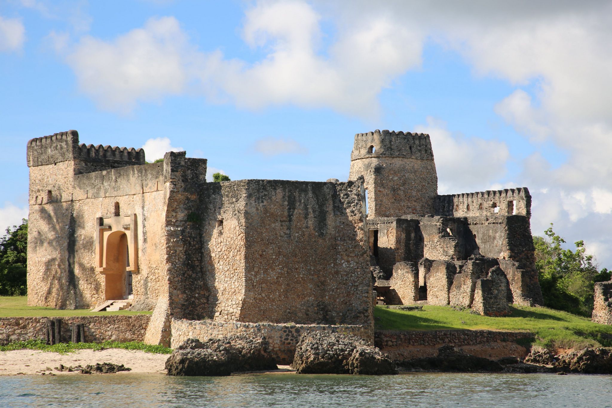
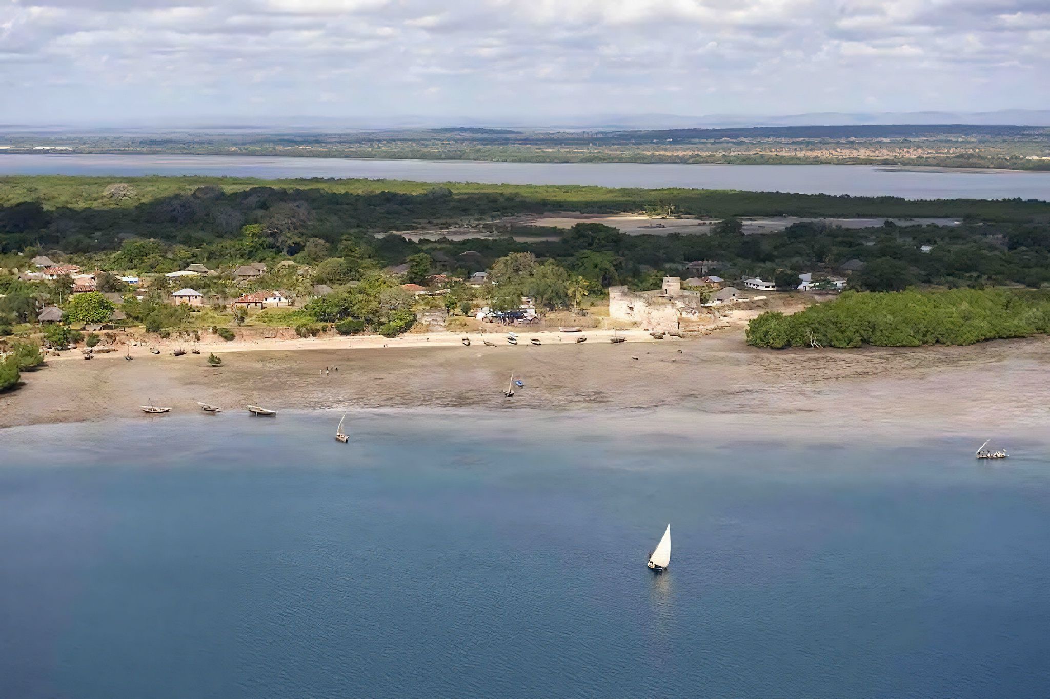
| Kilwa Kisiwani (World Heritage Site) | Magnificent and envied city in the past, Kilwa is now a peaceful island marked by impressive ruins. Visiting the island takes not less than two hours. Half a day to a full day is more appropriate for visiting all the ruins, seeing the village, observing the birds and exploring the shoreline. | Kisiwani Island can only be accessed by boat. Crossing with an engine boat takes approximately 20 minutes. Crossing by dhow is definitely more authentic but takes more time, depending on the wind conditions. 08°57'29.29"S; 39°29'57.60"E |
| Songo Mnara (World Heritage Site) | Like Kisiwani, Songo Mnara is an archaeological site of prime importance to the understanding of the Swahili culture. The landscape is marked with a series of impressive ruins dating back to the 15th century AD, when it was of a prominent stone town, with exceptional architectural details. | Songo Mnara lies 12 km south of Masoko, below Kisiwani Island. Engine boats take not less than 1 hour to reach the place. A visit to the ruins and the entire island makes for a good day trip. 09°02'24.09"S; 39°35'05.82"E |
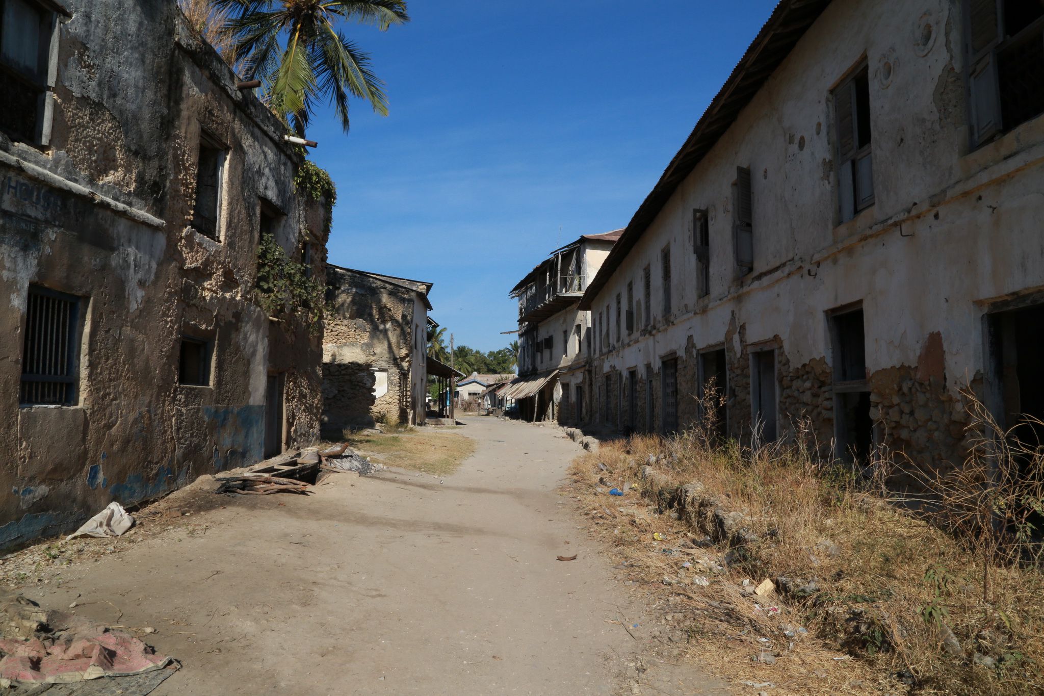
| Kilwa Kivinje (World Heritage Site) | Kilwa Kivinje is now a small atmospheric village with a Swahili village feel and an intriguing mix of German colonial and Omani Arab architecture, filled with ruins revealing the prosperous city it was in the 19th century. | Kivinje is a harbor located 25 km north of Masoko. It can be reached in 20 minutes by car from Masoko. Busses also link Kivinje to Masoko. The trip can also be done by bike in approximately 2 hours. 08°44'46.19"S; 39°24’46.22"E |
| Rukila Island (World Heritage Site) | The southern coast of Tanzania houses the highest levels of coral and fish biodiversity in the region. Snorkeling or scuba diving on a coral reef is unforgettable. Rukila is a perfect base for snorkeling, picnicking, watching birds or even sleeping at night as fishermen do. | This small island is 12 km away from Masoko harbour. It takes only 1:30 hr by boat to reach the place. At low tide, the island can also be reached by foot after a 3 hours walk on the sand, but this can be dangerous and requires an experienced guide to avoid being trapped by the ocean. 8°53'53.53"S; 39036'5.51"E |
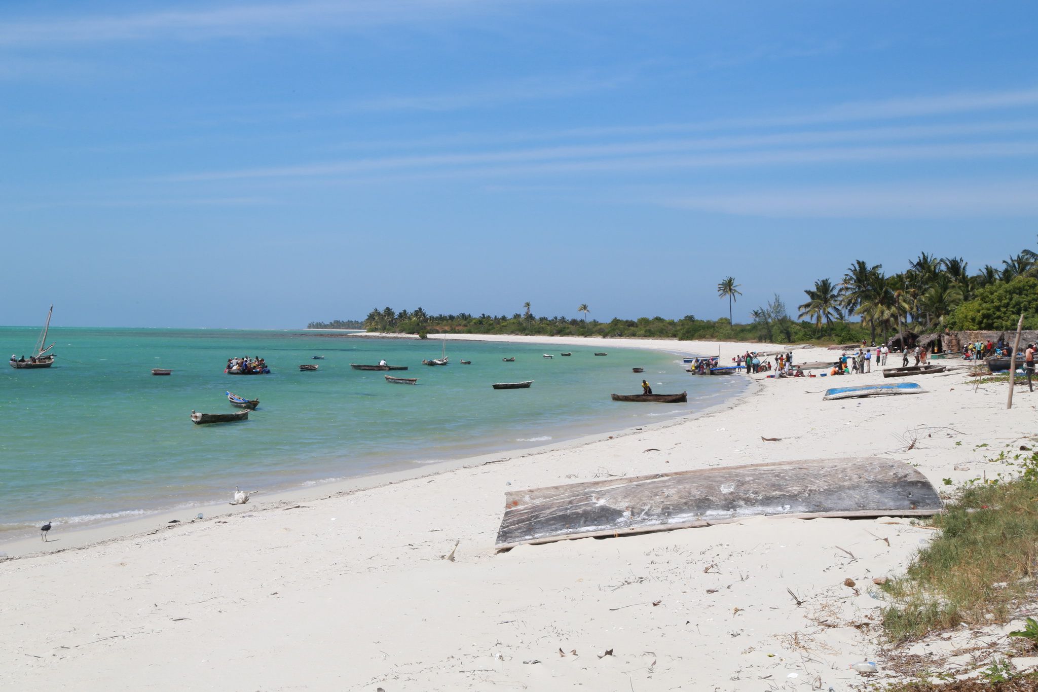
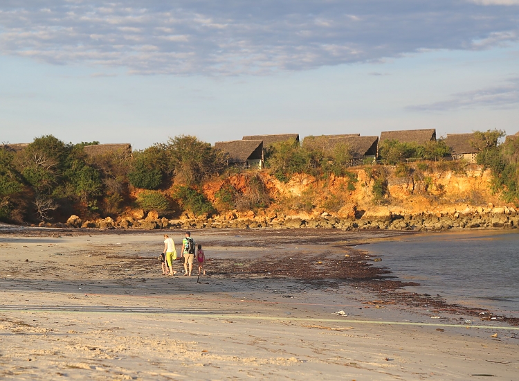
| Kilwa Masoko Fishing Habour | The fishing harbor is a wide sandy beach where Kilwa Masoko people meet with fishermen. It is a constantly busy place where many activities can be observed. This place worth seeing is also where boats are built or repaired. | In Kilwa Masoko |
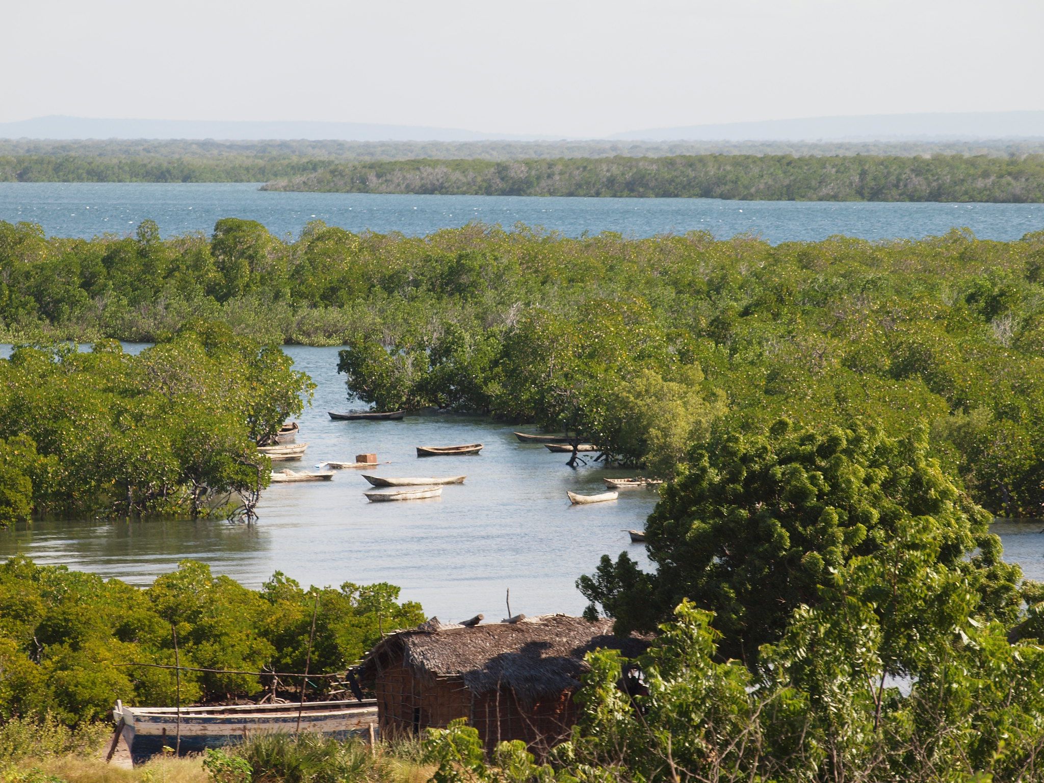
| Makubuli Fishermen Village | The village sits in a small creek in the mangrove where fishermen using small canoes prepare their nets and fix their boats. Many activities can be observed and good meals with fresh fish/crabs can be booked in advance. Tours on canoes offer a unique experience. Rich birdlife can also be observed around the mangrove. | On foot, this small fishing village is approximately 15 minutes away from Masoko market area. To access the place, ask for the Lutheran church. From the church, walk down to the water to reach the village. 08°55'32.33"S; 39°30’21.44"E |
| Ngazi ya Watumwa | This is a preserved coastal area, with interesting views on Kisiwani, rich flora and fauna, including marine life. It's an ideal spot to rest on a quiet sand beach and enjoy a picnic away from the busy market area. A few caves can also be seen within the cliffs. | This site is on the southern coast of Masoko, and faces Kilwa Kisiwani Island. It takes 10 min on bicycle to reach the place from Masoko centre, and 25 min only by foot. 08°56'22.57"S; 39°30'55.12"E |
| Kilwa Salt farms | Salt farms create a fascinating landscape behind the mangrove and are worth seeing. Salt is still harvested in the traditional way by men and women. Salt producers are very keen to see visitors and always ready to answer questions. | There are 36 salt producers in Kilwa Masoko. Accessing their farms is extremely easy on foot, bicycle or by car (10 minutes). Some farms are only accessible by boat and offer the opportunity to enjoy a nice excursion. |
| Jiwe la Jahazi | "Jiwe la Jahazi" means stone dhow. The legend says that this was a real dhow belonging to enemies who wanted to attack the village, but a special prayer (Al- badiir) changed them to stone. | This rock is located at the north eastern corner of Kisiwani Island. The place can be reached by boat from Masoko or by foot from Kisiwani port. 08°57'33.02"S; 39°32'07.84"E |
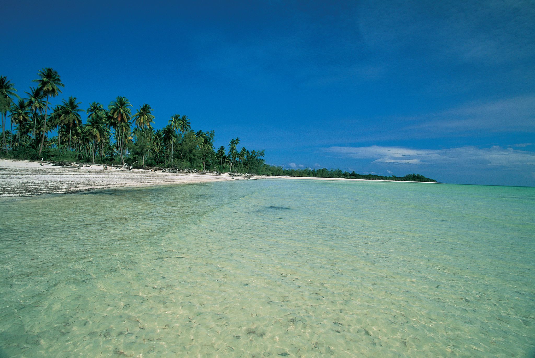
| Sanje ya Kati & Mbuyu Mbugu | The boat trip is an interesting experience through the mangrove, with a great variety of birds. On the way, you can also see all stages in the fishermen work, from catching the fishes to drying them on the beach. From the shore of the island, you can walk 20 minutes through the village to reach "Mbuyu Mbugu", an impressive baobab with hollow trunk. The white sand beach is ideal for resting, swimming and camping. | This island is located west of Songo Mnara, 14 km away from Masoko harbour. It can be reached by motor boat (45 min) or dhow (1h 30 min if the wind is conducive). 09°03'28.42"S; 39°31'43.27"E
|
| Pandawe Malalani | It is said that in this area, Unji Bin Unuki, a very tall person, sank in the mud. This legend is supported by a series of stones that represent his kitchen and footprints carved in the stone. | Pandawe site is located within Malalani village in Pande. It is about 135 kilometres from Masoko town and it takes two and half an hour to Malalani, by car. Then you walk for 15 minutes to the site. 09°07’13.16"S; 39°32'07.37''E |
| Mwanakiwambi | This is an archeological site that has not yet been conserved. It is therefore difficult to interpret the wall remains but the ruins are very close to the water shore. In this part of Songo Mnara, you can meet fishermen, camp and observe birds. You can also walk across the island and reach the sea side (1 km only). | The ruins are located at the south of Songo Mnara. The place can be reached by boat (2h 30 min) or Dhow from Masoko or by foot (4 hours) from Songo Mnara. 09°06'42.61"S; 39°35'59.84"E |
| Olelo bike trip | This excursion is ideal for a quiet pick nick in nature. Along the road, one can enjoy the rural activities and admire the vernacular architecture made of local materials. Many shops sell drinks and small snacks along the road, such as freshly made samosa. Monkeys can often be seen along the trail. | It takes 1hr and a half to reach this site that offers a great view on Kilwa wetlands and the salt farms. The first 9 km can easily be done on bicycle in less than an hour. You then have to walk 1,5 km inland. After 30 minutes of walk, you overlook the landscape. 08°51’35.25"S; 39°27'31.02"E |
| Masoko-Kivinje bike trip | Going to Kivinje by bike allows you to immerse into traditional architecture and landscapes, and allows for enjoyable encounters with the population. Kivinje is worth seeing and offers nice resting places at the harbor after the bicycle ride. | Kivinje is 25 km away from Masoko. Riding to Kivinje on bicycle is accessible to anyone in good physical condition. The trip takes two hours, ie four hours for the roundtrip. 18 km are on the paved road, the rest is done on an abandoned road near the littoral. Bikes can easily be rented in Masoko. |
| Matumbi Hill | The Matumbi Hills present amazing landscapes dotted with small villages, baobabs, rivers and carefully planted farms (bananas, coconut, cassava...). Walking through these landscapes is a very relaxing experience. The area also contains many caves. | The Matumbi hills are located to the west of Kilwa. The main village is Kipatimu, which sits on a hill. Kipatimu is 117 km away from Kilwa Masoko. Drive 67 km towards Njianne on the Dar road and turn left on the rough road. The 50 km trip from Njianne to Kipatimu takes approximately 1h 30 min. Kipatimu: 8°28'55.37"S; 38°55'8.68"E |
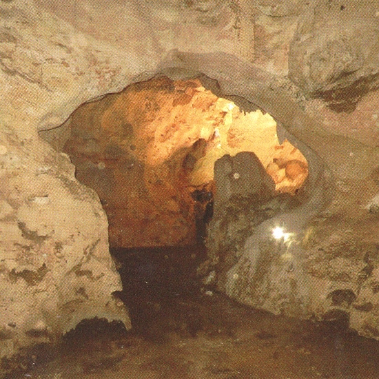
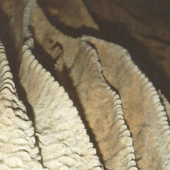
| Nandembo Caves | Several caves can be seen around Nandembo village. We recommend avoiding walking through Nangoma cave to stay away from the huge colony of bats. But the entrance with its huge vaulted roof spanning 68 meters is worth seeing. Nangoma was used as a hideaway during war times including for local rebel troops during the Maji Maji revolution. Another cave named Nangoma 2 is worth visiting for its white corridors carved by the water | The Caves are located in Nandembo Village, 8 km away from Kipatimu. Locating the place without a guide is not possible 08°30’38”S; 38°53’00”E
|
| Namaingo Caves | The Namaingo caves are interesting to visit for their network of organic corridors leading to different rooms, rivers and water reservoirs. The cave is sometimes used as well in the dry season. Some caves house important colonies of bats and should not be visited to avoid disturbing them. | The caves are located in Namaingo village, which is 12 km away from Kipatimu. Locating the place without a guide is not possible because the cave mouths are hidden in thick bushes. |
| Lake Maliwe | Maliwe is a peaceful lake where a few fishermen can take you on canoes dugout from a single log to observe the wildlife. Hippos and crocodiles can easily be seen, wide colonies of birds, frogs, and insects. In the dry season, large quantities of animals gather in to the lake to drink. You can then see monkeys, elephants, warthogs. | The lake is 84 km away from Masoko (3 hours). From Masoko, drive 29 km north Nagulukulu (30 min), then take the rough road going west and drive 53 km to y- (2,5 hours). Drive 2,5 km more towards Njinjo and park the car. The lake is 3 km (30 min walk). A guide should be hired in Ngea. 08°49'51.61"S; 38°59'36.67"E |
| Ngumbi ya Sukari | “Ngumbi ya Sukani” means stare, be careful. This dangerous place with strong and big rocks is well known by fishermen. The open view and the powerful waves splashing on big reefs are worth a visit. On the way, you can enjoy local farming systems and observe the rich birdlife. You can also visit ritual sites like Mbanga or Noro. | The place is located 36 km south of Masoko on the map. By road, it takes almost 2 hours to reach Nakimwela village, and a 45 min walk to the coast. If the monsoon winds allow, you can also access the site on a dhow from Kilwa Masoko within 3 hours. 09°14’39.62”S; 39°38'23.23”E |
| Rasi Ngu’mbi | Ras Ng'umbi is a rough coast carved by the sea waves. The strong waves hitting the coral rocks have created holes in the cliffs, creating amazing splashing waves. On the way to the site you can see different types of birds like hornbill, doves, eagle and many others. The site offers a nice view on the sea and the rest of the coast. On the same day, you can also visit Mkazambo graves, Mtumbu mosque, Mitimilu magic forest and the giant foot print. | The place is close to Lihimalyao, a village which is 123 km away from Kilwa Masoko. From the village, you need to walk 45 minutes to the sea side, along a white sand beach. Another one hour walk along the sea cliff brings you to the end of the peninsula. In total, 5 hours are needed from Lihimalyao to go, enjoy the site and come back. 09°16'12.14"S; 39°38'53.86"E |
| Mkurukara Caves | Mkurukara means “leader “, it was used as a shelter by a leader and his followers. There are 2 caves, one that served as a shelter, and the other that supplied fresh water. This water is still fetched by villagers to perform rituals. It is known to have strong healing and spiritual values. The caves have sheltered many communities during colonial era. They display amazing shapes, stalactites and stalagmites, and the temperature inside is cool. | The place is close to Lihimalyao, a village which is 123 km away from Kilwa Masoko. From the village, you need to walk 40 minutes to see the caves. You need a local guide to locate the caves and find the entrance, but also to perform rituals before entering. 09°20'24.84"S; 39°38'33.50"E |
| Mwanalinda water well and Ng’arwe Cave | The villagers from the nearest village depend on the water from these caves, which is believed to have healing properties but also magic powers that can relieve people from unlucky situations when used for bathing. | Mwanalinda well and Ng'arwe caves are located in southern Lihimalyao. They can only be accessed by car or motorcycle. The distance is 123 kilometres from Masoko Town then you walk for 15 minutes to reach the sites. 09°20’19.63"S; 39°37’55.86"E |
| Tung’ande Cave | This cave is well ventilated and easy to visit without using artificial light. The various rooms exhibit amazing shapes created by stalactites and stalagmites, including an elephant, a royal chair and a kitchen. More than 2 hours can be spent in the caves. | Tung'ande caves are found in Southern Lihimalyao. They are 123 kilometres away from Masoko. It takes 3 hours by car to reach the area and another 45 minutes by foot to see the caves. 09°21'01.39”S; 39°38'44.05"E |
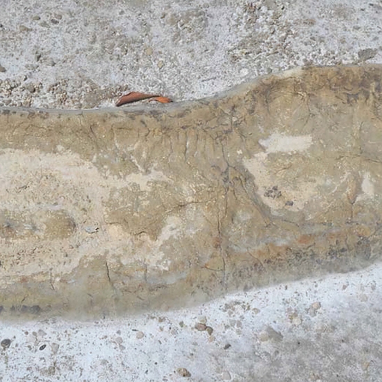
| Mtumba Mosque and Giant Footprint | The mosque was built by the Omanis in the 18th Century. It seats on the coast, inside the bay. The building is party in ruins, but large parts are still standing. Villagers consider the place sacred. This area also displays a large footprint on the ground. This print would belong to a giant person, Unji bin Unuki, who, according to oral tradition, was tall enough to catch a fish in the sea grill it with the sun. Unji bin Unuki is also known as Nanganana "Nangakumbi". | Mtumbu mosque and foot prints are located in Ruyaya village. The place can be accessed either by car or by boat, but using a car is faster. Ruyaya is located 123 kilometers away from Kilwa Masoko town. It takes 2 hours by car to arrive at the village, and 45 minutes to more to walk to the site. 09°23’56.85”S; 39°34'46.15"E |
| Kiswele | Kiswele is a fishermen village inside a quiet bay, where boat coming from the ocean can easily land. It also was the camping site of the British during the First World War. It was used as a strategic place to store ammunitions and hide. Inside Kiswele, you can dim hill called Pandawe where rituals are performed. | Kiswele village which is found in southern part of Kilwa District, it is about 120 kms from Masoko town, and takes 2 hours by car to reach the area, and then you walk for 15 minutes to the site 09°25'47.99"S; 39°33'21.10"E |
| Rushungi | Rushungi is a village where Indian traders established a storehouse and a port to ship sisal from Rushungi to Pangani Tanga, which was the hub for sisal trade during colonial times. Big dhows can still be seen in the bay, but the store houses are abandoned. The village has a very nice white sand beach and boat trips can be organised. Meals can be ordered in advance and taken on a small sand island. | Rushungi is a small village on the coast, located approximately 120 km away by road from Masoko. On the Lindi road, turn left 5 km after Mandawa village on a rough road. The place can be accessed by car within less than 3 hours from Masoko, no walk needed. 09°25’44.09"S; 39°35’56.29"E |
Ngurumu Mchakama Mavuji
| Ngurumu is a river which passes between two rock formations and supplies water to most of the villagers. Myths and beliefs are attached to this river and can be told by the local guides. The river is also called Mwalimkoto, after the name of a girl who disappeared in the river after fetching water when the tradition did not allow her to do so. | Ngurumu site is found at Mchakama, in Mavuji village. It can only be accessed by cat or motorcycle. Mchakama is approximately 65 km away from Masoko town. Going there takes about one and a half hour. 09°06’48.89"S; 39°15’02.77"E |
| Kiwawa Cave | It is a large and well ventilated cave, with enough light to walk without using torchlight. Clusters of stalactites and stalagmites create different shapes decorating the cave. | The main cave is located in Kiwawa village but some other caves can be found in Kiukula area. Kiwawa is about 70 km away from Masoko. Going there takes about 1h 30 min. You then need to walk for about 15 minutes to reach the site. 09°11’25.06"S; 39°21’34.52"E |
| Mandawa Village | The village has kept its authenticity and offers many opportunities for visits. Wildlife is very rich and the landscape is dotted with interesting physical features and sacred sites, where rituals are regularly performed. Short or long walks can be organized for bird watching, understanding traditional life or simply picnicking in the forest. | Mandawa is a small village located on the Lindi road, approximately 100 km away from Masoko. Access is possible by car or by public transport. From Masoko, It takes approximately 1h 20 min to reach Mandawa. 09°22’28.36"S; 39°26’15.69"E |
Mto Nyange Hippopotamus Pool
| The trip is a nice journey in beautiful landscapes and well preserved villages. Visits should be made when the water level is high and when hippos gather in large numbers in the forest. | Mto Nyange hippo pool is located in the southern part of Kilwa district, 140 km away from Masoko. Access is possible by car only, and takes approximately 3 hours. The journey ends with a 15 min walk in the forest. 09°34’8.76"S; 39°17'3.89"E |
| Nanjirinji bee keeping | Nanjirinji is renowned for the production of quality honey and natural bees' settlement. If you are lucky, you can see animals on the way, including impalas. The whole are is a conserved forest where ebony trees are grown and exploited in a sustainable way. | Nanjirinji village is found in the South-western part of Kilwa District. The distance from Masoko is 165 kilometres, and it takes approximately 3 hours by car. To reach the place where honey is harvested, you need to walk for about 45 minutes. 09°40’13.07"S; 39°06’35.95"E |
| Ritual Sites | The ritual dimension is an integral part of the culture of the district. These sites are highly respected by the population. People go there to ask for healing, obtain protection and seek support from the spirits in their activities. Some of these sites are linked to very interesting legends such as the Bangwe stone, which would be a petrified imam who did not comply with Koranic rules. | Ritual sites are scattered throughout the district, in towns and villages as well as in forests. These places are well known by the population but are generally hidden in remote places. |
Tours & Safaris
Packages to Kilwa


Destinations near Kilwa
These nearby destinations have a lot to offer


